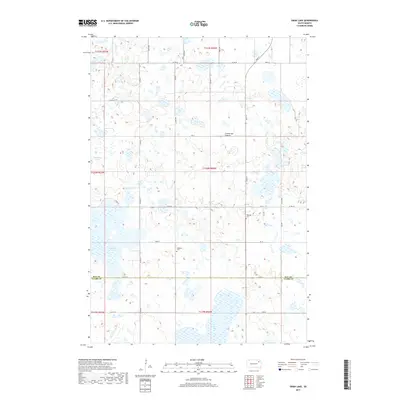
2017 Map of Swan Lake
USGS Topo · Published 2017About this map
Swan Lake and a series of glacial depressions define the landscape along the eastern edge of the Coteau des Prairies in this high-plains region. Spanning the boundary between Day and Clark Counties, the map reveals a prairie landscape dominated by water and section-line roads like Main St and Co Rd 30. The presence of Highland Cem and Hosanger Cem indicates the long-standing agricultural communities that have worked this land since the early years of settlement. The cluster of smaller bodies of water, including Mud Lake, Horseshoe Lake, and Long Lake, illustrates the pothole topography characteristic of this part of South Dakota, where the natural drainage patterns create a sanctuary for local wildlife amidst the expansive grid of the Public Land Survey System.
Find a feature on this map
28 named features on this map. Tap any name to fly to it.
Don’t see what you’re looking for? This feature index may not catch every label — zoom into the map to look around manually.
Map Details
Editions of this 2017 Swan Lake Map
This is the sole edition of this map. No revisions or reprints were ever made.
Other maps of this area

1953 · Milbank
USGS Topo · 1:250,000

1958 · Milbank
USGS Topo · 1:250,000

1970 · Waubay SW
USGS Topo · 1:24,000

1973 · Lily
USGS Topo · 1:24,000

1973 · Webster
USGS Topo · 1:24,000

1973 · Swan Lake
USGS Topo · 1:24,000

1973 · Bradley
USGS Topo · 1:24,000

1973 · Bristol East
USGS Topo · 1:24,000

1973 · Florence NW
USGS Topo · 1:24,000

1973 · Wallace
USGS Topo · 1:24,000