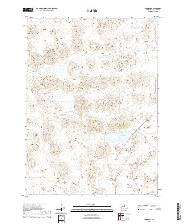
2021 Map of Swan Lake
USGS Topo · Published 2021About this map
The S Fork Elkhorn River winds through the heart of this Holt County landscape, anchoring a region defined by its diverse wetlands and water bodies. Significant features include the namesake Swan Lake, as well as Rush Lake, Round Lake, and Long Lake, which illustrate the high water table and natural drainage patterns of this Nebraska territory. The road network remains largely rural, following section lines and historical routes such as Fort Rd, Frontier Rd, and Davis Rd. Surveyed in the early 21st century, the map details the Public Land Survey System boundaries across several townships including t26n r15w and t25n r15w. This documentation captures a specific hydrological moment for the area, marking the extent of seasonal waters like Dry Cr and more permanent basins such as Dimmitt Lake and Clear Lake.
Find a feature on this map
23 named features on this map. Tap any name to fly to it.
Don’t see what you’re looking for? This feature index may not catch every label — zoom into the map to look around manually.
Map Details
Editions of this 2021 Swan Lake Map
This is the sole edition of this map. No revisions or reprints were ever made.
Other maps of this area

1955 · O'Neill
USGS Topo · 1:250,000

1959 · O'Neill
USGS Topo · 1:250,000

1964 · Emmet SW
USGS Topo · 1:24,000

1969 · O'Neill
USGS Topo · 1:250,000
1981 · Abbott Ranch
USGS Topo · 1:24,000

1981 · Swan Lake
USGS Topo · 1:24,000

1981 · Amelia
USGS Topo · 1:24,000

1981 · Bruner Lake
USGS Topo · 1:24,000
1981 · Carson Lake
USGS Topo · 1:24,000
1981 · Chain Lake
USGS Topo · 1:24,000