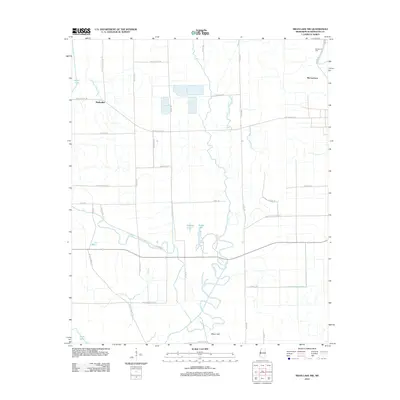
2012 Map of Swan Lake NW
USGS Topo · Published 2012About this map
Leroy Percy State Park sits at the heart of this Washington County landscape, where the winding course of Deer Cr and several oxbow lakes define the Delta terrain. The map records a distinctly rural agricultural character in the early 21st century, with long, straight roads like Avon Darlove Rd and Diane King Rd cutting across the alluvial plain. These roads often bear family names, providing valuable leads for genealogists tracing local landholdings. Small settlements such as Muskedine and McCutcheon anchor the area, while water features like Gamble Lake, Brushy Lake, and Moon Lake mark the legacy of shifting river channels. Near the northeastern corner, the Macedonia Cem stands along Old Hwy 61, representing a focal point for local family history and community heritage within this fertile basin.
Find a feature on this map
35 named features on this map. Tap any name to fly to it.
Don’t see what you’re looking for? This feature index may not catch every label — zoom into the map to look around manually.
Map Details
Editions of this 2012 Swan Lake NW Map
This is the sole edition of this map. No revisions or reprints were ever made.
Other maps of this area

1939 · Readland
USGS Topo · 1:62,500

1939 · Refuge
USGS Topo · 1:62,500

1939 · Tralake
USGS Topo · 1:62,500

1939 · Swan Lake
USGS Topo · 1:62,500

1953 · Greenwood
USGS Topo · 1:250,000

1956 · Greenwood
USGS Topo · 1:250,000
1967 · Tribbett
USGS Topo · 1:24,000

1967 · Arcola
USGS Topo · 1:24,000
1967 · Swan Lake NW
USGS Topo · 1:24,000
1967 · Percy
USGS Topo · 1:24,000