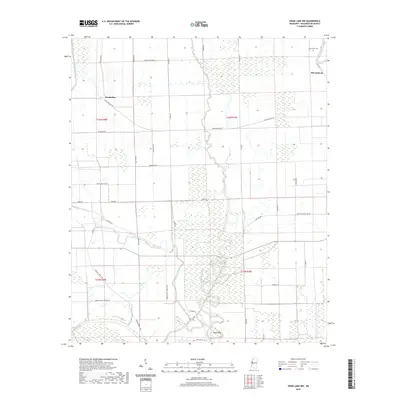
2020 Map of Swan Lake NW
USGS Topo · Published 2020About this map
Deer Creek and Puzzle Bayou wind through the fertile Delta landscape of Washington County, defining a region where water and agriculture remain inextricably linked. This modern 2020 survey captures the enduring rural character of the area, featuring scattered settlements such as Muskedine and McCutcheon. The terrain is characterized by numerous oxbow lakes and wetlands, including Brushy Lake, Gamble Lake, and Moon Lake, which are characteristic of the alluvial plain. Local history and genealogy are anchored by features like the Macedonia Cem near the northern boundary. The intricate network of local roads, such as Avon Darlove Rd and Woods Sawmill Rd, highlights the importance of timber and agricultural transport in the contemporary Mississippi Delta, while the southern edge touches the namesake Swan Lake.
Find a feature on this map
41 named features on this map. Tap any name to fly to it.
Don’t see what you’re looking for? This feature index may not catch every label — zoom into the map to look around manually.
Map Details
Editions of this 2020 Swan Lake NW Map
This is the sole edition of this map. No revisions or reprints were ever made.
Other maps of this area

1939 · Readland
USGS Topo · 1:62,500

1939 · Refuge
USGS Topo · 1:62,500

1939 · Tralake
USGS Topo · 1:62,500

1939 · Swan Lake
USGS Topo · 1:62,500

1953 · Greenwood
USGS Topo · 1:250,000

1956 · Greenwood
USGS Topo · 1:250,000
1967 · Tribbett
USGS Topo · 1:24,000

1967 · Arcola
USGS Topo · 1:24,000
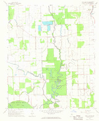
1967 · Swan Lake NW
USGS Topo · 1:24,000
1967 · Percy
USGS Topo · 1:24,000