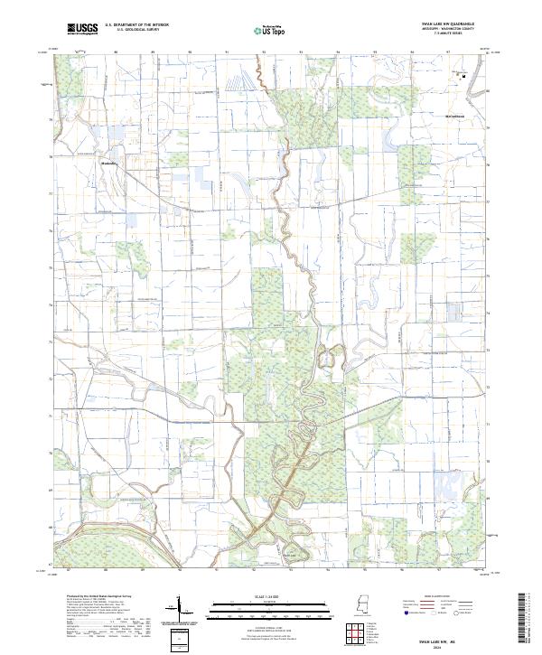
2024 Map of Swan Lake NW
USGS Topo · Published 2024About this map
Theodore Roosevelt National Wildlife Refuge and the Yazoo National Wildlife Refuge dominate this landscape, preserving a complex wetland ecosystem in the Mississippi Delta. The terrain is defined by the winding paths of Steele Bayou, Granicus Bayou, and Puzzle Bayou, which thread between oxbow formations like Swan Lake and Moon Lake. These waterways reflect the ancient shifting courses of the river system, creating a patchwork of swamp and forest.
Find a feature on this map
44 named features on this map. Tap any name to fly to it.
Don’t see what you’re looking for? This feature index may not catch every label — zoom into the map to look around manually.
Map Details
Editions of this 2024 Swan Lake NW Map
This is the sole edition of this map. No revisions or reprints were ever made.
Other maps of this area

1939 · Readland
USGS Topo · 1:62,500

1939 · Refuge
USGS Topo · 1:62,500

1939 · Tralake
USGS Topo · 1:62,500

1939 · Swan Lake
USGS Topo · 1:62,500

1953 · Greenwood
USGS Topo · 1:250,000

1956 · Greenwood
USGS Topo · 1:250,000
1967 · Tribbett
USGS Topo · 1:24,000

1967 · Arcola
USGS Topo · 1:24,000
1967 · Swan Lake NW
USGS Topo · 1:24,000
1967 · Percy
USGS Topo · 1:24,000