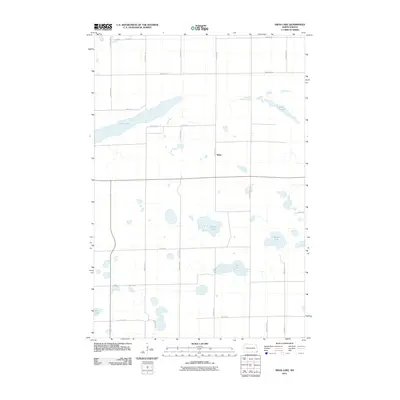
2011 Map of Swan Lake
USGS Topo · Published 2011About this map
Swan Lake and a series of distinct prairie wetlands dominate this portion of Richland County, reflecting the glacial topography of the North Dakota plains. The settlement of Stiles serves as a central landmark within a landscape defined by an orderly grid of section-line roads, including 160th Ave SE and 95th St SE. These thoroughfares connect scattered homesteads and agricultural tracts, bridging the spaces between named water bodies like Stacks Slough and Gullys Slough. To the south, Lueck Lake and Moran Lake further illustrate the region's concentration of natural basins. The map provides a clear look at the early 21st-century rural infrastructure, showing the persistence of the township's township-and-range road system amidst the numerous lakes and sloughs that define this part of Brightwood Township.
Find a feature on this map
24 named features on this map. Tap any name to fly to it.
Don’t see what you’re looking for? This feature index may not catch every label — zoom into the map to look around manually.
Map Details
Editions of this 2011 Swan Lake Map
This is the sole edition of this map. No revisions or reprints were ever made.
Other maps of this area

1904 · Wahpeton
USGS Topo · 1:125,000

1907 · Wyndmere
USGS Topo · 1:125,000

1917 · New Effington
USGS Topo · 1:62,500

1953 · Milbank
USGS Topo · 1:250,000

1953 · Fargo
USGS Topo · 1:250,000

1956 · Fargo
USGS Topo · 1:250,000

1958 · Milbank
USGS Topo · 1:250,000

1964 · Kreiser Lake
USGS Topo · 1:24,000

1964 · Hankinson
USGS Topo · 1:24,000

1964 · Mantador
USGS Topo · 1:24,000
Featured Places
- Brightwood Township, ND
- Belford Township, ND
- Elma Township, ND
- Moran Township, ND
- Liberty Grove Township, ND