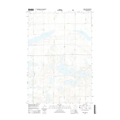
2014 Map of Swan Lake
USGS Topo · Published 2014About this map
Stiles sits at the heart of this Richland County landscape, where the prairie is defined by an intricate network of glacial wetlands and depressions. The geography is dominated by numerous water bodies including Swan Lake in the northwest and Stacks Slough to the northeast. Further south, the terrain holds Gullys Slough, Moran Lake, and Lueck Lake, illustrating the post-glacial hydrology characteristic of this part of North Dakota. The area is surveyed into a regular grid of section-line roads, such as 90th St SE and 160th Ave SE, which facilitate the region's agricultural movement. Primary transit through these wetlands is provided by ND-11 running east-west and ND-18 cutting north-south, intersecting near the drainage basins that pocket the landscape.
Find a feature on this map
23 named features on this map. Tap any name to fly to it.
Don’t see what you’re looking for? This feature index may not catch every label — zoom into the map to look around manually.
Map Details
Editions of this 2014 Swan Lake Map
This is the sole edition of this map. No revisions or reprints were ever made.
Other maps of this area

1904 · Wahpeton
USGS Topo · 1:125,000

1907 · Wyndmere
USGS Topo · 1:125,000

1917 · New Effington
USGS Topo · 1:62,500

1953 · Milbank
USGS Topo · 1:250,000

1953 · Fargo
USGS Topo · 1:250,000

1956 · Fargo
USGS Topo · 1:250,000

1958 · Milbank
USGS Topo · 1:250,000

1964 · Kreiser Lake
USGS Topo · 1:24,000

1964 · Hankinson
USGS Topo · 1:24,000

1964 · Mantador
USGS Topo · 1:24,000
Featured Places
- Brightwood Township, ND
- Belford Township, ND
- Elma Township, ND
- Moran Township, ND
- Liberty Grove Township, ND