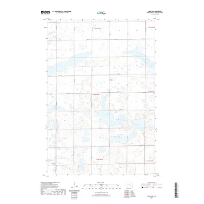
2020 Map of Swan Lake
USGS Topo · Published 2020About this map
Swan Lake and several large glacial depressions dominate this portion of Richland County, reflecting the watery geography of the Prairie Pothole Region. The small settlement of Stiles sits near the center of the quadrangle, serving as a landmark in a landscape defined by a precise grid of rural roads and section lines. The presence of Immanuel Lutheran Cem in the southwestern corner near Elm Lake provides a specific point of interest for genealogists tracing family histories in this agricultural township.
Find a feature on this map
32 named features on this map. Tap any name to fly to it.
Don’t see what you’re looking for? This feature index may not catch every label — zoom into the map to look around manually.
Map Details
Editions of this 2020 Swan Lake Map
This is the sole edition of this map. No revisions or reprints were ever made.
Other maps of this area

1904 · Wahpeton
USGS Topo · 1:125,000

1907 · Wyndmere
USGS Topo · 1:125,000

1917 · New Effington
USGS Topo · 1:62,500

1953 · Milbank
USGS Topo · 1:250,000

1953 · Fargo
USGS Topo · 1:250,000

1956 · Fargo
USGS Topo · 1:250,000

1958 · Milbank
USGS Topo · 1:250,000

1964 · Kreiser Lake
USGS Topo · 1:24,000

1964 · Hankinson
USGS Topo · 1:24,000

1964 · Mantador
USGS Topo · 1:24,000
Featured Places
- Brightwood Township, ND
- Belford Township, ND
- Elma Township, ND
- Moran Township, ND
- Liberty Grove Township, ND