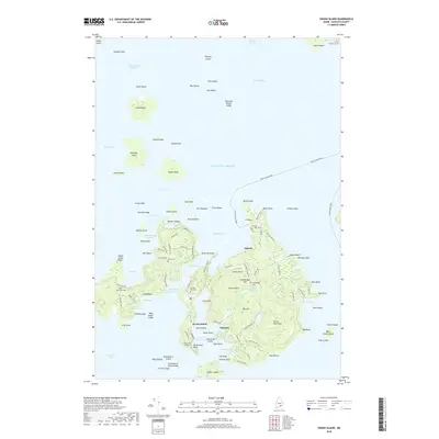
2018 Map of Swans Island
USGS Topo · Published 2018About this map
Swans Island anchors this coastal Maine survey, revealing a network of island communities connected by the Swans Island Ferry across Blue Hill Bay. The settlements of Atlantic, Minturn, and Swans Island are established around deep-water inlets like Burnt Coat Harbor and Mackerel Cove. The mapping of family-named roads, such as Rodericks Head Rd and Stanley Point Rd, alongside numerous cemeteries including Grindle Hill Cem and Hockamock Head Cem, offers significant detail for genealogical research.
Find a feature on this map
138 named features on this map. Tap any name to fly to it.
Don’t see what you’re looking for? This feature index may not catch every label — zoom into the map to look around manually.
Map Details
Editions of this 2018 Swans Island Map
This is the sole edition of this map. No revisions or reprints were ever made.
Other maps of this area

1904 · Deer Isle
USGS Topo · 1:62,500

1904 · Mount Desert
USGS Topo · 1:62,500

1904 · Swan Island
USGS Topo · 1:62,500

1904 · Bluehill
USGS Topo · 1:62,500

1905 · Penobscot Bay
USGS Topo · 1:125,000

1942 · Mount Desert
USGS Topo · 1:62,500

1942 · Deer Isle
USGS Topo · 1:62,500

1943 · Swans Island
USGS Topo · 1:62,500

1944 · Blue Hill
USGS Topo · 1:62,500

1944 · Deer Isle
USGS Topo · 1:62,500