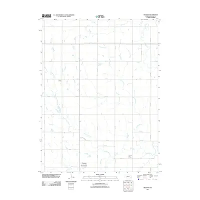
2011 Map of Swanton
USGS Topo · Published 2011About this map
Swanton serves as the primary hub of this rural landscape in Saline County, where the village and the Swanton Post Office sit at the intersection of a precise grid of county roads. The terrain is defined by a dense network of meandering waterways, including Swan Creek and its many tributaries. For local historians, the map preserves the exact locations of family and community landmarks such as the Waymire Cemetery and Plummers Branch Cemetery, which are situated on the higher ground between the various drainage basins. The landscape is characterized by its agricultural geometry, with fields bisected by Walnut Grove Creek and Plummers Branch. This 2011 survey illustrates the continued importance of water management and rural infrastructure in this corner of Nebraska, where the names of small creeks like Turkey Creek and Dry Creek remain key markers for land ownership and local navigation.
Find a feature on this map
29 named features on this map. Tap any name to fly to it.
Don’t see what you’re looking for? This feature index may not catch every label — zoom into the map to look around manually.
Map Details
Editions of this 2011 Swanton Map
This is the sole edition of this map. No revisions or reprints were ever made.
Other maps of this area

1897 · Lincoln
USGS Topo · 1:125,000

1935 · Dorchester
USGS Topo · 1:48,000

1940 · Dorchester
USGS Topo · 1:62,500

1955 · Lincoln
USGS Topo · 1:250,000

1957 · Lincoln
USGS Topo · 1:250,000

1957 · Plymouth
USGS Topo · 1:24,000

1957 · Wilber
USGS Topo · 1:24,000

1958 · Lincoln
USGS Topo · 1:250,000

1960 · Western SW
USGS Topo · 1:24,000

1961 · Western
USGS Topo · 1:24,000