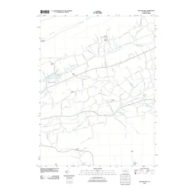
2010 Map of Swatara Hill
USGS Topo · Published 2010About this map
Upper Little Swatara Creek and its lower counterpart define the drainage patterns of this rural landscape, which includes the small settlements of Rock and Swatara Hill. This era shows a mix of agricultural tradition and recreation, evidenced by the presence of Camp Swatara and the Shikellamy Scout Camp in the southern reaches. Local family histories are etched into the geography via landmarks like Manbeck Cemetery and thoroughfares such as Hetzels Church Rd, Lengle Homestead Rd, and Manbeck Rd. Engineering features like the Sweet Arrow Lake Dam and the Black Creek Intake Dam indicate the management of local water resources for the surrounding communities. The map also highlights established recreation areas, including Eagle View Springs Golf Course and Hidden Valley Golf Course, positioned near the waters of Sweet Arrow Lake.
Find a feature on this map
79 named features on this map. Tap any name to fly to it.
Don’t see what you’re looking for? This feature index may not catch every label — zoom into the map to look around manually.
Map Details
Editions of this 2010 Swatara Hill Map
This is the sole edition of this map. No revisions or reprints were ever made.
Other maps of this area

1889 · Pottsville
USGS Topo · 1:62,500

1891 · Pottsville
USGS Topo · 1:62,500

1891 · Lebanon
USGS Topo · 1:62,500

1892 · Pine Grove
USGS Topo · 1:62,500

1893 · Lebanon
USGS Topo · 1:62,500

1899 · Lebanon
USGS Topo · 1:62,500

1902 · Wernersville
USGS Topo · 1:62,500

1943 · Lebanon
USGS Topo · 1:62,500

1943 · Wernersville
USGS Topo · 1:62,500

1944 · Pottsville
USGS Topo · 1:24,000
Featured Places
- Bethel Township, PA
- Reilly Township, PA
- Round Head, Bethel Township
- Deturksville, Washington Township
- Rock, Washington Township