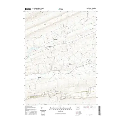
2016 Map of Swatara Hill
USGS Topo · Published 2016About this map
Blue Mountain and Sharp Mtn define the corrugated geography of this region along the Schuylkill Co and Berks Co border. Small residential clusters like Roedersville, De Turksville, and Stanhope are tucked between these ridgelines, connected by a network of rural roads such as Panther Valley Rd and Roedersville Rd. The drainage pattern is dominated by the Upper Little Swatara Cr and Lower Little Swatara Cr, with Sweet Arrow Lake serving as a significant water feature in the western portion of the quadrangle.
Find a feature on this map
104 named features on this map. Tap any name to fly to it.
Don’t see what you’re looking for? This feature index may not catch every label — zoom into the map to look around manually.
Map Details
Editions of this 2016 Swatara Hill Map
This is the sole edition of this map. No revisions or reprints were ever made.
Other maps of this area

1889 · Pottsville
USGS Topo · 1:62,500

1891 · Pottsville
USGS Topo · 1:62,500

1891 · Lebanon
USGS Topo · 1:62,500

1892 · Pine Grove
USGS Topo · 1:62,500

1893 · Lebanon
USGS Topo · 1:62,500

1899 · Lebanon
USGS Topo · 1:62,500

1902 · Wernersville
USGS Topo · 1:62,500

1943 · Lebanon
USGS Topo · 1:62,500

1943 · Wernersville
USGS Topo · 1:62,500

1944 · Pottsville
USGS Topo · 1:24,000
Featured Places
- Bethel Township, PA
- Reilly Township, PA
- Round Head, Bethel Township
- Deturksville, Washington Township
- Rock, Washington Township