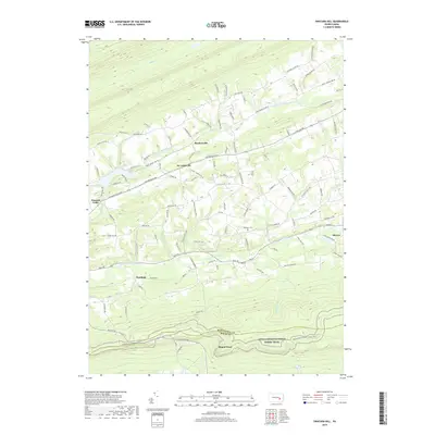
2019 Map of Swatara Hill
USGS Topo · Published 2019About this map
The Appalachian National Scenic Trail traverses the southern ridge of this landscape, crossing over the prominent Round Head along the Schuylkill Co Berks Co border. The terrain is defined by the parallel paths of Upper Little Swatara Cr and Lower Little Swatara Cr, which drain the valleys between numerous named rises like Birds Hill Rd and Flat Hill Rd. Small settlements and historic junctions are scattered throughout the rural landscape, including Roedersville, De Turksville, and Moyers.
Find a feature on this map
110 named features on this map. Tap any name to fly to it.
Don’t see what you’re looking for? This feature index may not catch every label — zoom into the map to look around manually.
Map Details
Editions of this 2019 Swatara Hill Map
This is the sole edition of this map. No revisions or reprints were ever made.
Other maps of this area

1889 · Pottsville
USGS Topo · 1:62,500

1891 · Pottsville
USGS Topo · 1:62,500

1891 · Lebanon
USGS Topo · 1:62,500

1892 · Pine Grove
USGS Topo · 1:62,500

1893 · Lebanon
USGS Topo · 1:62,500

1899 · Lebanon
USGS Topo · 1:62,500

1902 · Wernersville
USGS Topo · 1:62,500

1943 · Lebanon
USGS Topo · 1:62,500

1943 · Wernersville
USGS Topo · 1:62,500

1944 · Pottsville
USGS Topo · 1:24,000
Featured Places
- Bethel Township, PA
- Reilly Township, PA
- Round Head, Bethel Township
- Deturksville, Washington Township
- Rock, Washington Township