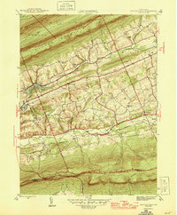
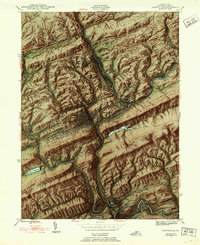
1946 Map of Swatara Hill
USGS Topo · Published 1946About this map
Blue Mountain and Second Mountain dominate this landscape just north of the Schuylkill Co Berks Co line during the mid-1940s. The region is defined by parallel ridges and the valleys of the Swatara Cr and Little Swatara Creek, where small settlements like Roedersville and Deturksville anchor the local community. The map reveals a dense network of early rural infrastructure, including numerous one-room schoolhouses such as Swartz Sch, Reed Sch, and Flat Hill Sch.
Find a feature on this map
34 named features on this map. Tap any name to fly to it.
Don’t see what you’re looking for? This feature index may not catch every label — zoom into the map to look around manually.
Map Details
Editions of this 1946 Swatara Hill Map
2 editions found
Other maps of this area

1889 · Pottsville
USGS Topo · 1:62,500

1891 · Pottsville
USGS Topo · 1:62,500

1891 · Lebanon
USGS Topo · 1:62,500

1892 · Pine Grove
USGS Topo · 1:62,500

1893 · Lebanon
USGS Topo · 1:62,500

1899 · Lebanon
USGS Topo · 1:62,500

1902 · Wernersville
USGS Topo · 1:62,500
1943 · Lebanon
USGS Topo · 1:62,500
1943 · Wernersville
USGS Topo · 1:62,500
1944 · Pottsville
USGS Topo · 1:24,000
Featured Places
- Bethel Township, PA
- Tremont Township, PA
- Reilly Township, PA
- Roedersville, Washington Township
- Pleasant Valley, Pine Grove Township