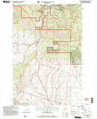
2003 Map of Swauk Prairie
USGS Topo · Published 2006About this map
Swauk Prairie dominates this landscape in the early 2000s, where the forested slopes of the Wenatchee National Forest meet the lower agricultural and ranching valleys of Kittitas County. The map provides significant genealogical value through the Swauk Prairie Cem, located near the intersection of W Ballard Hill Road and Ley Road. Settlement patterns are concentrated around nodes like Lauderdale Junction and the Green Canyon Ranch, reflecting a transition from public timberlands to private holdings. The complex water management of the region is evidenced by the North Branch Canal and numerous named drainages including Williams Creek and First Creek. Topographical features such as Ballard Hill and the dramatic drop into Hidden Valley illustrate the varied terrain. Several quarries appear throughout the southern canyons, suggesting local industrial activity within the folds of Horse Canyon and Green Canyon.
Find a feature on this map
33 named features on this map. Tap any name to fly to it.
Don’t see what you’re looking for? This feature index may not catch every label — zoom into the map to look around manually.
Map Details
Editions of this 2003 Swauk Prairie Map
This is the sole edition of this map. No revisions or reprints were ever made.
Other maps of this area

1897 · Mount Stuart
USGS Topo · 1:125,000

1902 · Mount Stuart
USGS Topo · 1:125,000

1957 · Wenatchee
USGS Topo · 1:250,000

1958 · Thorp
USGS Topo · 1:24,000

1958 · Thorp
USGS Topo · 1:62,500

1958 · Cle Elum
USGS Topo · 1:62,500
1958 · Ellensburg North
USGS Topo · 1:24,000

1961 · Liberty
USGS Topo · 1:62,500

1961 · Mount Stuart
USGS Topo · 1:62,500

1975 · Wenatchee
USGS Topo · 1:100,000