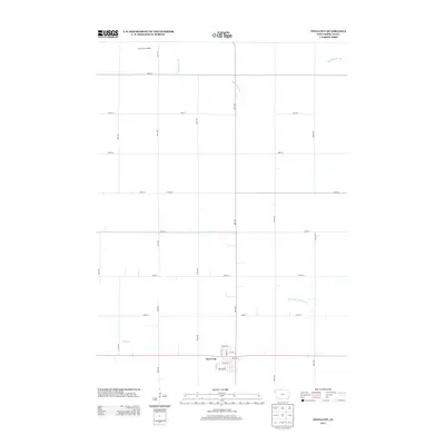
2013 Map of Swea City
USGS Topo · Published 2013About this map
Swea City sits in the southern portion of this northern Iowa quadrangle, defined by its rigid grid of numbered roads and agricultural waterways. The landscape reveals a highly managed prairie drainage system, with Ditch Number 60 and Mud Cr cutting through the farmland to join the W Br Blue Earth River. In the northern section, industrial agriculture is represented by the Rock N Sons Feedlot, a notable landmark in the rural expanse of Kossuth County. The town site itself shows a compact residential and commercial core with streets like Birch Ave W and Park Ave W, demonstrating the typical development of a rural crossroads community in the early 21st century. This survey documents the intersection of natural drainage and human engineering required to maintain the region's productive agricultural economy.
Find a feature on this map
27 named features on this map. Tap any name to fly to it.
Don’t see what you’re looking for? This feature index may not catch every label — zoom into the map to look around manually.
Map Details
Editions of this 2013 Swea City Map
This is the sole edition of this map. No revisions or reprints were ever made.
Other maps of this area

1954 · Fairmont
USGS Topo · 1:250,000

1958 · Fairmont
USGS Topo · 1:250,000

1967 · Pilot Grove
USGS Topo · 1:24,000

1967 · East Chain
USGS Topo · 1:24,000

1967 · Wilmert Lake
USGS Topo · 1:24,000

1972 · Bancroft
USGS Topo · 1:24,000

1972 · Ledyard
USGS Topo · 1:24,000

1980 · Seneca
USGS Topo · 1:24,000

1980 · Armstrong
USGS Topo · 1:24,000

1980 · Swea City
USGS Topo · 1:24,000