
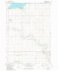
1980 Map of Armstrong
USGS Topo · Published 1980About this map
The Armstrong community serves as the central hub of this northern Iowa landscape, situated just south of the Minnesota border. The town is oriented around the Chicago and North Western rail line and the winding course of the Des Moines River, which flows through the southwestern corner of the quadrangle. This area highlights a transition between structured agricultural townships like Armstrong Grove and Wea and the extensive natural wetland preserves to the north.
Find a feature on this map
25 named features on this map. Tap any name to fly to it.
Don’t see what you’re looking for? This feature index may not catch every label — zoom into the map to look around manually.
Map Details
Editions of this 1980 Armstrong Map
This is the sole edition of this map. No revisions or reprints were ever made.
Other maps of this area

1954 · Fairmont
USGS Topo · 1:250,000

1958 · Fairmont
USGS Topo · 1:250,000

1967 · East Chain
USGS Topo · 1:24,000

1967 · Wilmert Lake
USGS Topo · 1:24,000

1970 · Wilbert
USGS Topo · 1:24,000

1980 · Seneca
USGS Topo · 1:24,000

1980 · Ringsted
USGS Topo · 1:24,000

1980 · Swea City
USGS Topo · 1:24,000

1980 · Armstrong SE
USGS Topo · 1:24,000
1980 · Dolliver
USGS Topo · 1:24,000