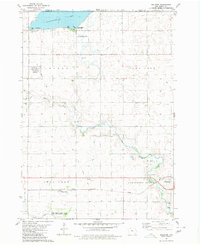
1980 Map of Dolliver
USGS Topo · Published 1980About this map
Okamanpeedan Lake and its surrounding conservation areas define this northern Emmet County landscape, where the Minnesota border meets the headwaters of the East Fork Des Moines River. The 1970s land use captured here shows a balance between recreational state parks and the industrial legacy of the Chicago Rock Island and Pacific Railroad. Small rail-dependent settlements like Dolliver, Gridley, and Maple Hill are clearly documented, along with the extensive network of agricultural drainage channels such as Ditch No 68 and Ditch No 35 that transformed the prairie. Local history is anchored by several rural burial grounds, including Armstrong Grove Cem and Mt Calvary Cem, which serve as vital markers for genealogists tracing family ties to the townships of Lincoln and Armstrong Grove.
Find a feature on this map
29 named features on this map. Tap any name to fly to it.
Don’t see what you’re looking for? This feature index may not catch every label — zoom into the map to look around manually.
Map Details
Editions of this 1980 Dolliver Map
This is the sole edition of this map. No revisions or reprints were ever made.
Other maps of this area

1954 · Fairmont
USGS Topo · 1:250,000

1958 · Fairmont
USGS Topo · 1:250,000

1967 · Wilmert Lake
USGS Topo · 1:24,000

1970 · Ceylon
USGS Topo · 1:24,000

1970 · Wilbert
USGS Topo · 1:24,000

1980 · Seneca
USGS Topo · 1:24,000

1980 · Armstrong
USGS Topo · 1:24,000

1980 · Ringsted
USGS Topo · 1:24,000

1980 · Ingham Lake
USGS Topo · 1:24,000

1980 · Gruver
USGS Topo · 1:24,000