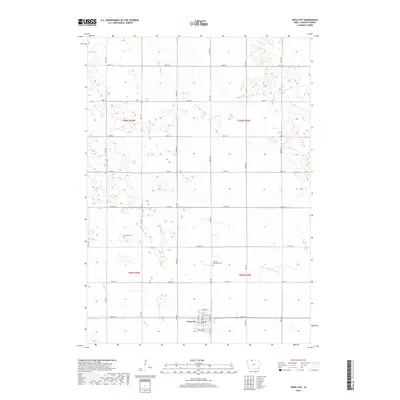
2018 Map of Swea City
USGS Topo · Published 2018About this map
Swea City anchors the southern portion of this northern Iowa landscape, where the Jeffersonian grid of rural roads defines the movement of modern agriculture. The town is organized around a core of local streets including Park Ave and Birch Ave W, while the surrounding prairie is divided by long stretches of gravel and paved routes like Co Rd A21 and 80th Ave. Significant local landmarks for genealogists include the Harrison Township Cem and the Lutheran Cem, which reflect the area's pioneer heritage. Water management is a primary feature of the terrain, characterized by the W Br Blue Earth River and the artificial engineering of Ditch Number 60, illustrating the transformation of the tallgrass prairie into productive farmland.
Find a feature on this map
32 named features on this map. Tap any name to fly to it.
Don’t see what you’re looking for? This feature index may not catch every label — zoom into the map to look around manually.
Map Details
Editions of this 2018 Swea City Map
This is the sole edition of this map. No revisions or reprints were ever made.
Other maps of this area

1954 · Fairmont
USGS Topo · 1:250,000

1958 · Fairmont
USGS Topo · 1:250,000

1967 · Pilot Grove
USGS Topo · 1:24,000

1967 · East Chain
USGS Topo · 1:24,000

1967 · Wilmert Lake
USGS Topo · 1:24,000

1972 · Bancroft
USGS Topo · 1:24,000

1972 · Ledyard
USGS Topo · 1:24,000

1980 · Seneca
USGS Topo · 1:24,000

1980 · Armstrong
USGS Topo · 1:24,000

1980 · Swea City
USGS Topo · 1:24,000