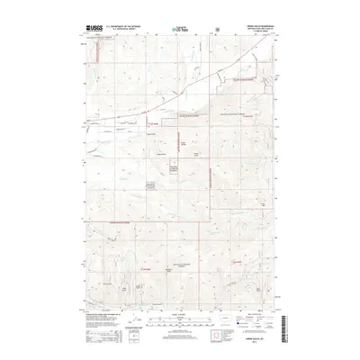
2014 Map of Swede Gulch
USGS Topo · Published 2014About this map
Helena National Forest dominates this mountain landscape, where the headwaters of the Blackfoot River gather from numerous drainages. The terrain is defined by steep elevation changes, rising toward Crater Mtn in the east and dropping into deep ravines like Swede Gulch and Rochester Gulch. The hydrology of the area is particularly complex, featuring the Grosfield Ditch and the convergence of Landers Fork with other mountain streams.
Find a feature on this map
40 named features on this map. Tap any name to fly to it.
Don’t see what you’re looking for? This feature index may not catch every label — zoom into the map to look around manually.
Map Details
Editions of this 2014 Swede Gulch Map
This is the sole edition of this map. No revisions or reprints were ever made.
Other maps of this area

1889 · Helena
USGS Topo · 1:250,000

1893 · Helena
USGS Topo · 1:250,000

1899 · Helena
USGS Topo · 1:250,000

1903 · Coopers Lake
USGS Topo · 1:125,000

1903 · Helena
USGS Topo · 1:250,000

1943 · Hogan
USGS Topo · 1:125,000

1947 · Butte
USGS Topo · 1:250,000

1955 · Choteau
USGS Topo · 1:250,000

1957 · Choteau
USGS Topo · 1:250,000

1958 · Butte
USGS Topo · 1:250,000