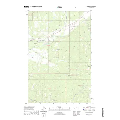
2020 Map of Swede Gulch
USGS Topo · Published 2020About this map
The Blackfoot River and its major tributary, the Landers Fork, define the drainage patterns of this high-altitude landscape in Helena National Forest. Irrigation efforts in the northern valley are evidenced by the Grosfield Ditch, while the steep southern terrain is carved by a series of drainages including Ethel Gulch, Rochester Gulch, and Davis Gulch. These features, along with Crater Mtn, reflect the topography of the Continental Divide region. The network of forest roads such as Stemple Pass Rd and Humbug Contour Rd provides insight into the accessibility of this timber and mining country. Small-scale development appears along Patterson Loop and Snow Fleury Ln, showing the modern human footprint within the larger wilderness context.
Find a feature on this map
44 named features on this map. Tap any name to fly to it.
Don’t see what you’re looking for? This feature index may not catch every label — zoom into the map to look around manually.
Map Details
Editions of this 2020 Swede Gulch Map
This is the sole edition of this map. No revisions or reprints were ever made.
Other maps of this area

1889 · Helena
USGS Topo · 1:250,000

1893 · Helena
USGS Topo · 1:250,000

1899 · Helena
USGS Topo · 1:250,000

1903 · Coopers Lake
USGS Topo · 1:125,000

1903 · Helena
USGS Topo · 1:250,000

1943 · Hogan
USGS Topo · 1:125,000

1947 · Butte
USGS Topo · 1:250,000

1955 · Choteau
USGS Topo · 1:250,000

1957 · Choteau
USGS Topo · 1:250,000

1958 · Butte
USGS Topo · 1:250,000