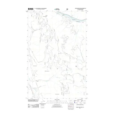
2011 Map of Swede Mountain
USGS Topo · Published 2011About this map
Swede Mountain and its northern peak, Big Swede Lookout, dominate this mountainous landscape in the Kootenai National Forest. The northern boundary is defined by the winding course of the Kootenai River, while the southern reaches are marked by Tangen Mountain and McMillan Mountain. This 2011 survey captures the network of forest service roads and specialized industrial routes, such as the Champion Haul Rd, that serve the timber and transportation needs of this portion of Lincoln County. In the southwest corner, aviation and public safety infrastructure is evident at the Libby Airport and the Cabinet View Fire Dept. Small water bodies and drainages, including Lost Lake, McMillan Creek, and Johnson Draw, underscore the complex hydrology of the region as it funnels toward the primary river valley.
Find a feature on this map
28 named features on this map. Tap any name to fly to it.
Don’t see what you’re looking for? This feature index may not catch every label — zoom into the map to look around manually.
Map Details
Editions of this 2011 Swede Mountain Map
This is the sole edition of this map. No revisions or reprints were ever made.
Other maps of this area

1920 · Libby
USGS Topo · 1:125,000

1920 · Jennings
USGS Topo · 1:125,000

1930 · Libby
USGS Topo · 1:125,000

1932 · Libby
USGS Topo · 1:125,000

1935 · Thompson Lakes
USGS Topo · 1:96,000

1942 · Thompson Lakes
USGS Topo · 1:125,000

1957 · Kalispell
USGS Topo · 1:250,000

1960 · Kalispell
USGS Topo · 1:250,000

1961 · Kalispell
USGS Topo · 1:250,000

1963 · Vermiculite Mountain
USGS Topo · 1:24,000