
1963 Map of Vermiculite Mountain
USGS Topo · Published 1966About this map
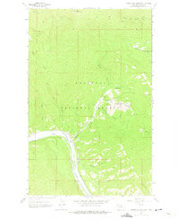
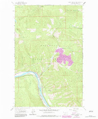
Vermiculite Mountain serves as the focal point for intensive industrial activity within the Kootenai National Forest, as shown in this mid-1960s survey. The landscape is defined by extensive mining infrastructure, including a Tramway, Strip Mine, and large Tailings deposits and Mine Dumps north of Rainy Creek. This industrial footprint contrasts with the steep terrain of the Cabinet Mountains, where a Lookout Tower sits atop Blue Mountain. Along the valley floor, the Kootenai River provides a corridor for the Great Northern railroad, passing the small settlement of Ripley and the Bakker Ranch. The presence of an Aqueduct and numerous gulches, such as Kennedy Gulch and Tulu Gulch, highlights the complex water management required to support both the natural drainage of Rice Creek and the localized extraction efforts at the heart of the quadrangle.
Find a feature on this map
26 named features on this map. Tap any name to fly to it.
Don’t see what you’re looking for? This feature index may not catch every label — zoom into the map to look around manually.
Map Details
Editions of this 1963 Vermiculite Mountain Map
3 editions found
Other maps of this area

1920 · Libby
USGS Topo · 1:125,000

1920 · Jennings
USGS Topo · 1:125,000

1930 · Libby
USGS Topo · 1:125,000

1932 · Libby
USGS Topo · 1:125,000

1935 · Thompson Lakes
USGS Topo · 1:96,000

1942 · Thompson Lakes
USGS Topo · 1:125,000

1957 · Kalispell
USGS Topo · 1:250,000

1960 · Kalispell
USGS Topo · 1:250,000

1961 · Kalispell
USGS Topo · 1:250,000

1963 · Swede Mountain
USGS Topo · 1:24,000