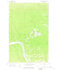
1963 Map of Vermiculite Mountain
USGS Topo · Published 1975About this map
Industrial activity and rugged logistics define this 1963 survey of the Kootenai National Forest in northwest Montana. The landscape is dominated by the extraction efforts surrounding Vermiculite Mountain, where a complex infrastructure of a Tramway, Aqueduct, and several Strip Mine sites connects the mineral resources to the transport corridors below. The heavy footprint of mining, including substantial Tailings and Mine Dump locations, is contrasted by the natural course of the Kootenai River and the winding path of the Great Northern railroad.
Find a feature on this map
26 named features on this map. Tap any name to fly to it.
Don’t see what you’re looking for? This feature index may not catch every label — zoom into the map to look around manually.
Map Details
Editions of this 1963 Vermiculite Mountain Map
3 editions found
Other maps of this area

1920 · Libby
USGS Topo · 1:125,000

1920 · Jennings
USGS Topo · 1:125,000

1930 · Libby
USGS Topo · 1:125,000

1932 · Libby
USGS Topo · 1:125,000

1935 · Thompson Lakes
USGS Topo · 1:96,000

1942 · Thompson Lakes
USGS Topo · 1:125,000

1957 · Kalispell
USGS Topo · 1:250,000

1960 · Kalispell
USGS Topo · 1:250,000

1961 · Kalispell
USGS Topo · 1:250,000

1963 · Vermiculite Mountain
USGS Topo · 1:24,000