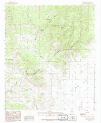
1986 Map of Swede Peak
USGS Topo · Published 1986About this map
Chiricahua Mountains terrain dominates this 1986 survey, where the high ridges of the Coronado National Forest descend into the broad reaches of the San Simon Valley and San Bernardino Valley. The map highlights a remote landscape structured by deep drainage systems such as Tex Canyon, Rustler Canyon, and Price Canyon. Within the protected Chiricahua Wilderness, landmarks like Swede Peak and Sunset Peak provide vertical orientation for a region defined by its scarce water sources. Notable life-sustaining points include Cottonwood Corral Spring and High Lonesome Spring, the latter situated near the prominent Lonesome Ridge. This provisional edition records the footpaths and unimproved roads used by ranchers and hikers before modern digital mapping, preserving the specific nomenclature of the canyons and gulches that define this portion of Cochise County.
Find a feature on this map
26 named features on this map. Tap any name to fly to it.
Don’t see what you’re looking for? This feature index may not catch every label — zoom into the map to look around manually.
Map Details
Editions of this 1986 Swede Peak Map
2 editions found
Other maps of this area

1917 · Chiricahua
USGS Topo · 1:125,000

1919 · Chiricahua
USGS Topo · 1:125,000

1926 · Rodeo
USGS Topo · 1:62,500

1926 · Rucker
USGS Topo · 1:62,500

1926 · Pedregosa
USGS Topo · 1:62,500

1940 · Apache
USGS Topo · 1:62,500

1955 · Douglas
USGS Topo · 1:250,000

1958 · Chiricahua Peak
USGS Topo · 1:62,500

1958 · Apache
USGS Topo · 1:62,500
1958 · Pedregosa Mountains
USGS Topo · 1:62,500