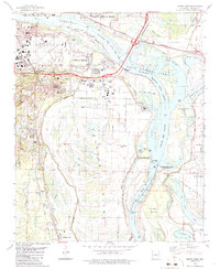
1986 Map of Sweet Home
USGS Topo · Published 1986About this map
Industrial development and riparian geography define this 1986 survey of the riverfront south of Little Rock. The Arkansas River dominates the landscape, featuring a complex system of bypasses like Jones Cut-off and Willow Bar Cut-off that frame Fourche Island. Aviation and commerce are central to the era's footprint, anchored by the Adams Field Municipal Airport and the sprawling Little Rock Port Industrial Park.
Find a feature on this map
69 named features on this map. Tap any name to fly to it.
Don’t see what you’re looking for? This feature index may not catch every label — zoom into the map to look around manually.
Map Details
Editions of this 1986 Sweet Home Map
This is the sole edition of this map. No revisions or reprints were ever made.
Other maps of this area

1891 · Little Rock
USGS Topo · 1:125,000

1893 · Little Rock
USGS Topo · 1:125,000

1935 · Mc Almont
USGS Topo · 1:24,000

1935 · Little Rock
USGS Topo · 1:24,000

1935 · Sweet Home
USGS Topo · 1:24,000

1935 · North Little Rock
USGS Topo · 1:24,000

1935 · Alexander
USGS Topo · 1:48,000

1939 · Keo
USGS Topo · 1:31,680

1940 · Woodson
USGS Topo · 1:31,680

1941 · Alexander
USGS Topo · 1:62,500