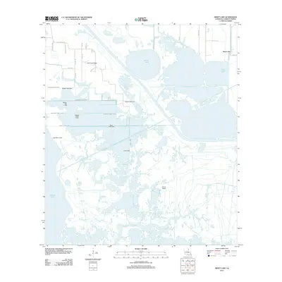
2012 Map of Sweet Lake
USGS Topo · Published 2012About this map
Grosse Savanne and the surrounding marshlands of Cameron Parish define this coastal landscape, where water and low-lying ridges dictate the pattern of human settlement. The map reveals an intricate network of waterways, from the expansive Willow Lake and Sweet Lake to the engineered precision of the Number One Canal and Lake Shore Canal. These channels cut through the wetlands, supporting both drainage and navigation in a region dominated by the influence of Calcasieu Lake.
Find a feature on this map
37 named features on this map. Tap any name to fly to it.
Don’t see what you’re looking for? This feature index may not catch every label — zoom into the map to look around manually.
Map Details
Editions of this 2012 Sweet Lake Map
This is the sole edition of this map. No revisions or reprints were ever made.
Other maps of this area

1932 · Moss Lake
USGS Topo · 1:31,680

1932 · Lake Charles SW
USGS Topo · 1:31,680

1932 · Lake Charles SE
USGS Topo · 1:31,680

1934 · Cameron
USGS Topo · 1:24,000

1934 · Sweet Lake
USGS Topo · 1:24,000

1934 · Grand Bayou
USGS Topo · 1:24,000

1934 · Boudreaux Lake
USGS Topo · 1:24,000

1935 · Cameron
USGS Topo · 1:31,680

1935 · Sweet Lake
USGS Topo · 1:31,680

1935 · Hackberry
USGS Topo · 1:31,680