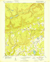
1949 Map of Sweet Valley
USGS Topo · Published 1949About this map
Mountain Springs sits in the high mountain country of northwestern Luzerne County, surrounded by the steep ridges of North Mountain and Fairmount. This 1949 survey documents a landscape of high-elevation water bodies and specialized industry, featuring the Splash Dam and nearby Beech Lake. The terrain is characterized by expansive wetlands like The Meadows and Bates Swamp, which feed a network of waterways including Bowman Creek and Huntington Creek. To the south, the landscape transitions into a more settled rural pattern centered on Sweet Valley. The map records several small schoolhouses and churches that served these isolated communities, including the Retreat Sch at Kyttle and the Mott Sch near Harris Pond. This era preserves the footprint of small-scale agriculture and mountain industry before modern development altered the rural character of Ross and Hunlock townships.
Find a feature on this map
53 named features on this map. Tap any name to fly to it.
Don’t see what you’re looking for? This feature index may not catch every label — zoom into the map to look around manually.
Map Details
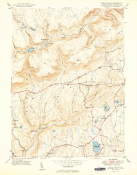
Editions of this 1949 Sweet Valley Map
2 editions found
Other maps of this area

1891 · Harveys Lake
USGS Topo · 1:62,500

1893 · Harvey Lake
USGS Topo · 1:62,500

1894 · Shickshinny
USGS Topo · 1:62,500

1894 · Bloomsburg
USGS Topo · 1:62,500

1934 · Laporte
USGS Topo · 1:62,500

1946 · Nanticoke
USGS Topo · 1:31,680

1946 · Shickshinny
USGS Topo · 1:31,680

1946 · Dutch Mtn
USGS Topo · 1:24,000

1946 · Harveys Lake
USGS Topo · 1:24,000

1946 · Noxen
USGS Topo · 1:24,000
Featured Places
- Hunlock Township, PA
- Prichard, Hunlock Township
- Lake Township, PA
- Sweet Valley, Ross Township
- Ripple, Fairmount Township