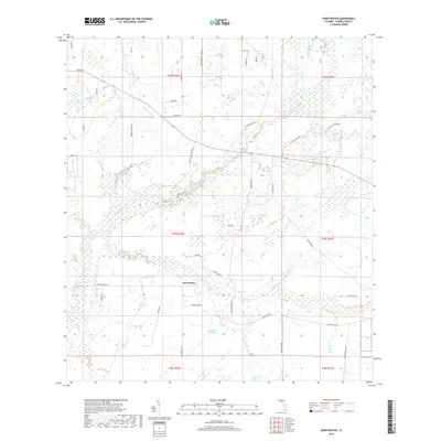
2018 Map of Sweetwater
USGS Topo · Published 2018About this map
Sweetwater serves as the focal point of this agricultural and wetland landscape in Hardee County, situated amidst a network of natural drainages. The area is defined by its numerous gullies and branches, including Fivemile Gully and the winding course of Charlie Cr. Local hydrology is further represented by Lake Florence and the headwaters of Sweetwater Branch. The settlement pattern is characterized by long rural routes and family-named roads that suggest a history of ranching and citrus farming. Names like Davis Ranch Rd and Oak Hill Ranches Rd reflect the land use common to this part of the Florida interior. The presence of Ten Mile Grade in the southeastern quadrant points to the historical importance of elevated roadbeds for traversing the low-lying, often marshy terrain characteristic of the region.
Find a feature on this map
45 named features on this map. Tap any name to fly to it.
Don’t see what you’re looking for? This feature index may not catch every label — zoom into the map to look around manually.
Map Details
Editions of this 2018 Sweetwater Map
This is the sole edition of this map. No revisions or reprints were ever made.
Other maps of this area

1953 · Avon Park
USGS Topo · 1:24,000

1953 · Crewsville SE
USGS Topo · 1:24,000

1953 · Crewsville
USGS Topo · 1:24,000

1955 · Wauchula
USGS Topo · 1:24,000

1956 · Gardner
USGS Topo · 1:24,000

1956 · Sweetwater
USGS Topo · 1:24,000

1956 · Zolfo Springs
USGS Topo · 1:24,000

1956 · Crewsville SW
USGS Topo · 1:24,000

1956 · Griffins Corner
USGS Topo · 1:24,000

1956 · Fort Pierce
USGS Topo · 1:250,000