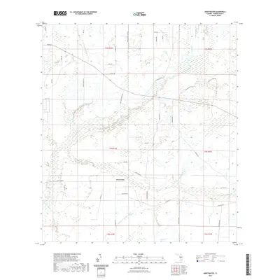
2021 Map of Sweetwater
USGS Topo · Published 2021About this map
Sweetwater sits at the heart of this Hardee County landscape, where the flat interior of Florida is defined by a complex network of wetlands and seasonal drainages. The area is characterized by several distinctive depressions and watercourses, including Adeline Bay and the small Lake Florence just south of the main settlement. The drainage patterns here are intricate, with Charlie Cr and various gullies like Yosemite Gully and Punch Gully carving through the terrain. A sparse grid of local roads, such as Crewsville Rd and Ten Mile Grade, connects scattered rural homesteads and agricultural operations. The map documents the persistent nature of these Florida wetlands, with named branches like Sweetwater Branch and Fish Branch feeding into larger systems, illustrating the hydrological character of the region in the early 21st century.
Find a feature on this map
53 named features on this map. Tap any name to fly to it.
Don’t see what you’re looking for? This feature index may not catch every label — zoom into the map to look around manually.
Map Details
Editions of this 2021 Sweetwater Map
This is the sole edition of this map. No revisions or reprints were ever made.
Other maps of this area

1953 · Avon Park
USGS Topo · 1:24,000

1953 · Crewsville SE
USGS Topo · 1:24,000

1953 · Crewsville
USGS Topo · 1:24,000

1955 · Wauchula
USGS Topo · 1:24,000

1956 · Gardner
USGS Topo · 1:24,000

1956 · Sweetwater
USGS Topo · 1:24,000

1956 · Zolfo Springs
USGS Topo · 1:24,000

1956 · Crewsville SW
USGS Topo · 1:24,000

1956 · Griffins Corner
USGS Topo · 1:24,000

1956 · Fort Pierce
USGS Topo · 1:250,000