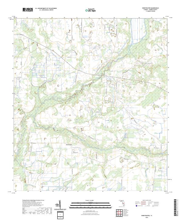
2024 Map of Sweetwater
USGS Topo · Published 2024About this map
Charlie Creek winds through the heart of this Hardee County landscape, serving as a primary drainage for a network of smaller tributaries and gullies. The settlement of Sweetwater is located just south of Lake Florence, anchored by local routes like Sweetwater Rd and Crewsville Rd. This modern survey reveals a mosaic of wetland features and watercourses, including the wide Adeline Bay and several named branches such as Mineral Branch and Jackson Branch. To the south and east, the land is etched by Oak Creek and Parks Creek, while smaller drainages like Fivemile Gully and Punch Gully define the local topography. The map illustrates a contemporary pattern of rural development, marked by numerous private ranch roads and named agricultural lanes that branch off from primary thoroughfares.
Find a feature on this map
49 named features on this map. Tap any name to fly to it.
Don’t see what you’re looking for? This feature index may not catch every label — zoom into the map to look around manually.
Map Details
Editions of this 2024 Sweetwater Map
This is the sole edition of this map. No revisions or reprints were ever made.
Historical Maps of Sweetwater Through Time
4 maps found