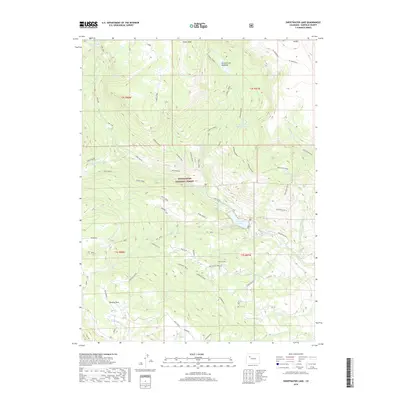
2019 Map of Sweetwater Lake
USGS Topo · Published 2019About this map
The White River National Forest dominates this landscape, where the waters of Sweetwater Creek feed into the prominent Sweetwater Lake. This high-altitude region of Garfield County is characterized by a complex network of seasonal drainage and glacial features, including the high summits of Turret Peak and Shingle Peak. The settlement pattern is sparse, reflecting the area's role as a center for summer grazing and forest management, anchored by the Sweetwater Cow Camp.
Find a feature on this map
53 named features on this map. Tap any name to fly to it.
Don’t see what you’re looking for? This feature index may not catch every label — zoom into the map to look around manually.
Map Details
Editions of this 2019 Sweetwater Lake Map
This is the sole edition of this map. No revisions or reprints were ever made.
Other maps of this area

1927 · Glenwood Springs
USGS Topo · 1:125,000

1930 · Glenwood Springs
USGS Topo · 1:125,000

1957 · Leadville
USGS Topo · 1:250,000

1959 · Leadville
USGS Topo · 1:250,000

1960 · Leadville
USGS Topo · 1:250,000

1962 · Leadville
USGS Topo · 1:250,000

1964 · Leadville
USGS Topo · 1:250,000
1974 · Dotsero
USGS Topo · 1:24,000
1974 · Broken Rib Creek
USGS Topo · 1:24,000
1974 · Carbonate
USGS Topo · 1:24,000