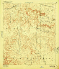
1893 Map of Sweetwater
USGS Topo · Published 1917About this map
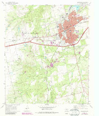
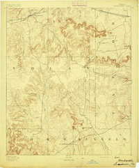
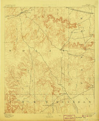
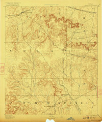
Sweetwater serves as the primary hub of this late 19th-century West Texas landscape, positioned where the Texas and Pacific Railway cuts through the northern plains. This 1891 survey, published by the Department of the Interior, documents the transition from the rolling cattle country of Nolan and Taylor counties into the breaks and mesas further south. Prominent landmarks such as Castle Peak and Church Mountain break the horizon, providing essential orientation for early travelers moving between the railroad towns and the military outpost at Fort Chadbourne near the southern border. The intricate network of drainage, including Sweetwater Creek and the deep cuts of Mulberry Canyon, reveals a rugged geography that dictated the placement of small early settlements like Hylton and Nubia, many of which remained isolated from the rail lines for decades.
Find a feature on this map
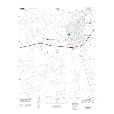
35 named features on this map. Tap any name to fly to it.
Don’t see what you’re looking for? This feature index may not catch every label — zoom into the map to look around manually.
Map Details
Editions of this 1893 Sweetwater Map
4 editions found
Historical Maps of Sweetwater Through Time
8 maps found