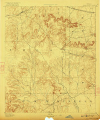
1893 Map of Sweetwater
USGS Topo · Published 1922About this map
The Texas and Pacific Railway defines the northern development of this West Texas frontier, connecting the growing hub of Sweetwater with Trent and Merkel. Surveyed in the early 1890s, the landscape transitions from the rail-oriented settlements in Nolan and Taylor counties to the more isolated outposts of the south. Fort Chadbourne stands as a significant historical marker in Coke County, near the convergence of Oak Creek and Coyote Creek.
Find a feature on this map
34 named features on this map. Tap any name to fly to it.
Don’t see what you’re looking for? This feature index may not catch every label — zoom into the map to look around manually.
Map Details
Editions of this 1893 Sweetwater Map
4 editions found
Other maps of this area

1890 · Abilene
USGS Topo · 1:125,000

1891 · Hayrick
USGS Topo · 1:125,000

1891 · Anson
USGS Topo · 1:125,000

1892 · Abilene
USGS Topo · 1:125,000

1892 · Ballinger
USGS Topo · 1:125,000

1893 · Roby
USGS Topo · 1:125,000

1893 · Anson
USGS Topo · 1:125,000

1893 · Sweetwater
USGS Topo · 1:125,000

1894 · Hayrick
USGS Topo · 1:125,000

1921 · Bronte
USGS Topo · 1:31,680