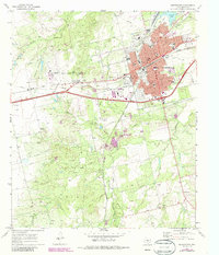
1969 Map of Sweetwater
USGS Topo · Published 1987About this map
Sweetwater serves as a major hub for West Texas commerce in this late 1960s study, defined by the meeting of the Missouri Pacific and Atchison Topeka and Santa Fe railroads. The town's grid is dense with civic and educational landmarks, including the central Courthouse, Reagan High Sch, and Southeast Sch. Just west of the city center, Avenger Village sits adjacent to the Municipal Airport, where an Airway Beacon marks the high ground near several Gravel Pits.
Find a feature on this map
36 named features on this map. Tap any name to fly to it.
Don’t see what you’re looking for? This feature index may not catch every label — zoom into the map to look around manually.
Map Details
Editions of this 1969 Sweetwater Map
2 editions found
Other maps of this area

1893 · Roby
USGS Topo · 1:125,000

1893 · Sweetwater
USGS Topo · 1:125,000

1954 · Big Spring
USGS Topo · 1:250,000

1958 · Big Spring
USGS Topo · 1:250,000

1969 · Busby
USGS Topo · 1:24,000

1969 · Bench Mountain
USGS Topo · 1:24,000

1969 · Bernecker
USGS Topo · 1:24,000

1969 · Roscoe
USGS Topo · 1:24,000

1969 · Eskota
USGS Topo · 1:24,000

1969 · Sweetwater
USGS Topo · 1:24,000