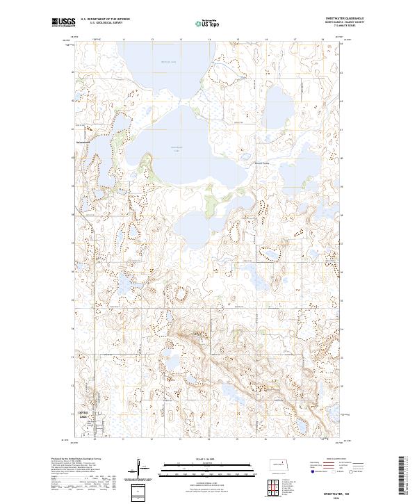
2024 Map of Sweetwater
USGS Topo · Published 2024About this map
Sweetwater Lake and Morrison Lake dominate this Ramsey County landscape, connected by the narrow channel of Edmore Coulee. The topography illustrates a complex system of prairie wetlands and seasonal basins typical of the region's terminal drainage patterns. In the southern portion of the map, the northern reaches of Devils Lake appear near the specialized campus of Lake Region State College, which sits at the intersection of College Dr and Academy Rd. The northeastern quadrant is defined by the Ramsey County Waterfowl Production Area, a significant conservation tract that preserves the shoreline of Morrison Lake. Local transportation is managed through a strict grid of section-line roads, including 57th St NE and 84th Ave NE, which serve the small settlement of Sweetwater.
Find a feature on this map
32 named features on this map. Tap any name to fly to it.
Don’t see what you’re looking for? This feature index may not catch every label — zoom into the map to look around manually.
Map Details
Editions of this 2024 Sweetwater Map
This is the sole edition of this map. No revisions or reprints were ever made.
Other maps of this area

1931 · Devils Lake
USGS Topo · 1:62,500

1950 · Devils Lake
USGS Topo · 1:62,500

1951 · Crary
USGS Topo · 1:24,000

1951 · Devils Lake
USGS Topo · 1:24,000

1951 · Grand Harbor
USGS Topo · 1:24,000

1951 · Camp Grafton
USGS Topo · 1:24,000

1951 · Sweetwater
USGS Topo · 1:24,000

1953 · Devils Lake
USGS Topo · 1:250,000

1956 · Devils Lake
USGS Topo · 1:250,000

1957 · Starkweather SE
USGS Topo · 1:24,000