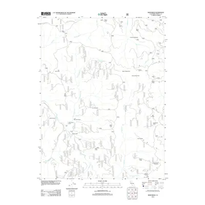
2012 Map of Swim Ridge
USGS Topo · Published 2012About this map
Mad River and its several forks dictate the movement and terrain of this Trinity County landscape, carving through high ridges and canyons just after the turn of the 21st century. The confluence at Three Forks highlights the meeting of the N Fork Mud River and the main river channel, while prominent landmarks like Van Horn Peak and Horsehead Mountain provide vertical contrast to the deep gulches. Small, localized clearings such as Cleveland Meadow and the site at Double Cabins suggest long-standing, if sparse, human activity in this corner of the national forest.
Find a feature on this map
39 named features on this map. Tap any name to fly to it.
Don’t see what you’re looking for? This feature index may not catch every label — zoom into the map to look around manually.
Map Details
Editions of this 2012 Swim Ridge Map
This is the sole edition of this map. No revisions or reprints were ever made.
Other maps of this area

1918 · Anada
USGS Topo · 1:62,500

1921 · Hoaglin
USGS Topo · 1:62,500

1922 · Island Mountain
USGS Topo · 1:62,500

1931 · Hoaglin
USGS Topo · 1:96,000

1935 · Hoaglin
USGS Topo · 1:125,000

1953 · Blackrock Mtn
USGS Topo · 1:62,500

1954 · Pickett Peak
USGS Topo · 1:62,500

1954 · Dubakella Mtn
USGS Topo · 1:62,500

1954 · Blackrock Mtn
USGS Topo · 1:62,500
1955 · Kettenpom
USGS Topo · 1:62,500