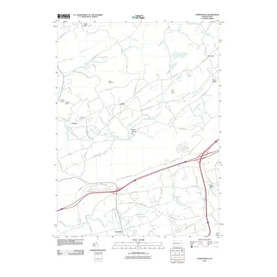
2010 Map of Sybertsville
USGS Topo · Published 2010About this map
Hess Mountain and Council Cup define the topographical relief of this northern Pennsylvania landscape, where several distinct creek systems converge. The southern edge of the map features the village of Sybertsville and the nearby Saint Johns community, both positioned along the developed transit corridors north of Nescopeck. Moving north, the map reveals a pattern of smaller named settlements such as Hobbie and Scanlin, alongside agricultural land and family-named landmarks like the Groover Cemetery. The drainage of Big Wapwallopen Creek and Balliet Run provides a natural structure to the terrain between Moyers Grove and Dorrance. From the Council Cup Scenic Overlook in the west to the small Clarks Hill Airport in the east, this survey shows the blend of rural residential life and preserved wooded heights characteristic of the region.
Find a feature on this map
83 named features on this map. Tap any name to fly to it.
Don’t see what you’re looking for? This feature index may not catch every label — zoom into the map to look around manually.
Map Details
Editions of this 2010 Sybertsville Map
This is the sole edition of this map. No revisions or reprints were ever made.
Other maps of this area

1889 · Hazleton
USGS Topo · 1:62,500

1891 · Wilkesbarre
USGS Topo · 1:62,500

1891 · Hazleton
USGS Topo · 1:62,500

1892 · Mahanoy
USGS Topo · 1:62,500

1893 · Hazleton
USGS Topo · 1:62,500

1893 · Mahanoy
USGS Topo · 1:62,500

1894 · Shickshinny
USGS Topo · 1:62,500

1894 · Wilkesbarre
USGS Topo · 1:62,500

1943 · Scranton
USGS Topo · 1:125,000

1944 · Newark
USGS Topo · 1:250,000
Featured Places
- Dorrance Township, PA
- Conyngham Township, PA
- Slocum Township, PA
- Nescopeck Township, PA
- Feys Grove, Dorrance Township