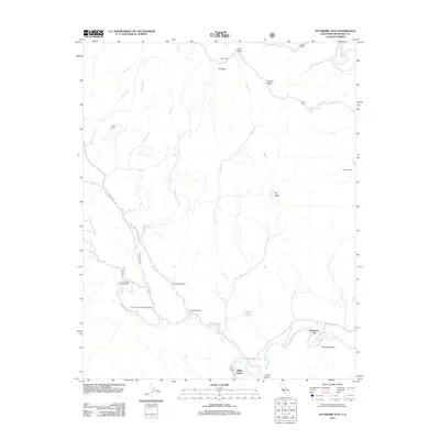
2012 Map of Sycamore Flat
USGS Topo · Published 2012About this map
Arroyo Seco and the winding course of the Piney Creek define this section of the Central Coast interior. The landscape is marked by remote ranching outposts and family-named landmarks, including Hicks Ranch, Fritch Ranch, Millers Ranch, and George Ranch, alongside the notable Hermits Cabin to the east. Transportation through this terrain relies on the Carmel Valley Road and Arroyo Seco Road, which connect the scattered settlements and recreational sites. Camping facilities such as Piney Creek Campground and Lower Piney Creek Campground are situated along the creek, while the presence of The Dry Lake and the broad expanse of Grandmas Flat illustrate the seasonal hydrology and geographic character of the Sycamore Flat area. Elevations vary from the depths of Horse Canyon and Long Canyon to the heights of Eli Peak and Twin Peaks.
Find a feature on this map
31 named features on this map. Tap any name to fly to it.
Don’t see what you’re looking for? This feature index may not catch every label — zoom into the map to look around manually.
Map Details
Editions of this 2012 Sycamore Flat Map
This is the sole edition of this map. No revisions or reprints were ever made.
Other maps of this area

1910 · Soledad
USGS Topo · 1:31,680

1915 · Soledad
USGS Topo · 1:62,500

1919 · Junipero Serra
USGS Topo · 1:62,500

1920 · Jamesburg
USGS Topo · 1:48,000

1921 · Jamesburg
USGS Topo · 1:62,500

1921 · Lucia
USGS Topo · 1:62,500

1939 · Jamesburg
USGS Topo · 1:62,500

1940 · Jamesburg
USGS Topo · 1:62,500

1940 · Soledad
USGS Topo · 1:62,500

1941 · Lucia
USGS Topo · 1:62,500