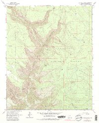
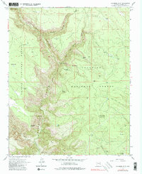
1963 Map of Sycamore Point
USGS Topo · Published 1987About this map
Sycamore Canyon dominates this landscape where the borders of the Kaibab National Forest, Coconino National Forest, and Prescott National Forest converge. This 1960s-era survey reveals a network of remote water sources and backcountry infrastructure, ranging from cattle tanks like Everett Tank and Railroad Draw Tanks to numerous seeps such as Geronimo Spring and Babes Hole Spring.
Find a feature on this map
43 named features on this map. Tap any name to fly to it.
Don’t see what you’re looking for? This feature index may not catch every label — zoom into the map to look around manually.
Map Details
Editions of this 1963 Sycamore Point Map
5 editions found
Other maps of this area

1886 · San Francisco Mtns
USGS Topo · 1:250,000

1886 · Chino
USGS Topo · 1:250,000

1887 · Verde
USGS Topo · 1:250,000

1887 · Prescott
USGS Topo · 1:250,000

1891 · San Francisco Mtns
USGS Topo · 1:250,000

1891 · Chino
USGS Topo · 1:250,000

1892 · Verde
USGS Topo · 1:250,000

1892 · Prescott
USGS Topo · 1:250,000

1894 · San Francisco Mtns
USGS Topo · 1:250,000

1899 · San Francisco Mtns
USGS Topo · 1:250,000