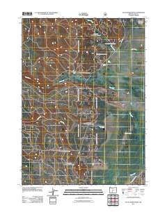
2011 Map of Sycan Marsh West
USGS Topo · Published 2011About this map
Sycan Marsh dominates this landscape in northern Lake County, where the sprawling wetlands meet the timbered reaches of the Fremont National Forest. This remote basin is defined by its complex hydrology, with Coyote Creek, Long Creek, and Dry Creek all feeding into the larger marsh system before joining the Sycan River to the south. The human footprint in this high-desert environment is sparse, centered on working land like Carton Ranch and logistical points such as Camp Fifteen. Forest Service access roads like Nfd 288 Rd provide the primary infrastructure through the rugged terrain, supporting both ranching and conservation efforts. Water remains the critical resource here, marked by features like Cold Spring which serve as vital points in an otherwise arid region.
Find a feature on this map
10 named features on this map. Tap any name to fly to it.
Don’t see what you’re looking for? This feature index may not catch every label — zoom into the map to look around manually.
Map Details
Editions of this 2011 Sycan Marsh West Map
This is the sole edition of this map. No revisions or reprints were ever made.
Other maps of this area

1889 · Klamath
USGS Topo · 1:250,000

1894 · Klamath
USGS Topo · 1:250,000

1955 · Klamath Falls
USGS Topo · 1:250,000

1958 · Klamath Falls
USGS Topo · 1:250,000

1960 · Riverbed Butte
USGS Topo · 1:62,500

1960 · Sycan Marsh
USGS Topo · 1:62,500

1960 · Fuego Mountain
USGS Topo · 1:62,500

1960 · Yamsay Mountain
USGS Topo · 1:62,500

1980 · Williamson River
USGS Topo · 1:100,000
1988 · Sycan Marsh West
USGS Topo · 1:24,000