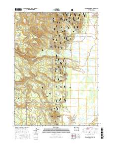
2017 Map of Sycan Marsh West
USGS Topo · Published 2017About this map
Sycan Marsh dominates the eastern half of this landscape, its intricate hydrology defined by the Sycan River and a network of seasonal watercourses. To the west, the terrain rises into the timbered reaches of the Fremont National Forest, where the topography is incised by drainage systems such as Long Cr and Dry Cr. This 2017 survey details a landscape where water management and forest access are paramount, showing the transition from marshland to upland forest. Notable for researchers is the distribution of water sources like Cold Spring and Coyote Cr, which have historically dictated land use in this part of Lake County. Access is maintained through a system of forest routes, including the Natl Forest Develop Road 28B Rd and Fs 27, which provide the primary transit corridors through the wooded western sections.
Find a feature on this map
13 named features on this map. Tap any name to fly to it.
Don’t see what you’re looking for? This feature index may not catch every label — zoom into the map to look around manually.
Map Details
Editions of this 2017 Sycan Marsh West Map
This is the sole edition of this map. No revisions or reprints were ever made.
Other maps of this area

1889 · Klamath
USGS Topo · 1:250,000

1894 · Klamath
USGS Topo · 1:250,000

1955 · Klamath Falls
USGS Topo · 1:250,000

1958 · Klamath Falls
USGS Topo · 1:250,000

1960 · Riverbed Butte
USGS Topo · 1:62,500

1960 · Sycan Marsh
USGS Topo · 1:62,500

1960 · Fuego Mountain
USGS Topo · 1:62,500

1960 · Yamsay Mountain
USGS Topo · 1:62,500

1980 · Williamson River
USGS Topo · 1:100,000
1988 · Sycan Marsh West
USGS Topo · 1:24,000