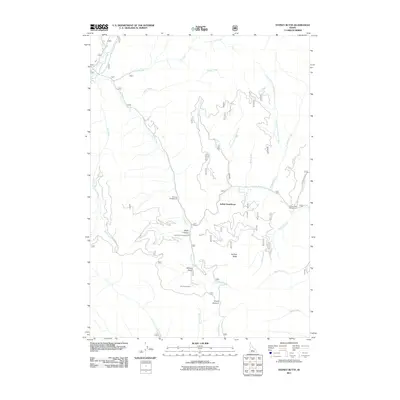
2011 Map of Sydney Butte
USGS Topo · Published 2011About this map
Five Points Mine stands as a primary industrial marker in this high-altitude landscape within the Sawtooth National Forest area of Idaho. The terrain is defined by a dense network of drainage systems, including Little Smoky Creek, Worswick Creek, and the North Fork Soldier Creek, which converge among prominent peaks and summits. High points like Sydney Butte and Couch Summit overlook a region shaped by both geologic features and recreational access. Distinctive landmarks such as Indian Head Rock and Wash Canyon punctuate the ridges, while established sites like Narrows Campground and Five Points Campground indicate the modern land use for backcountry access and forest management. This 2011 survey documents the intricate creek systems and forest roads that facilitate mining and recreation in the Camas County backcountry.
Find a feature on this map
27 named features on this map. Tap any name to fly to it.
Don’t see what you’re looking for? This feature index may not catch every label — zoom into the map to look around manually.
Map Details
Editions of this 2011 Sydney Butte Map
This is the sole edition of this map. No revisions or reprints were ever made.
Other maps of this area

1900 · Sawtooth
USGS Topo · 1:125,000

1955 · Hailey
USGS Topo · 1:250,000

1957 · Fairfield
USGS Topo · 1:62,500

1957 · Blaine
USGS Topo · 1:62,500

1959 · Hailey
USGS Topo · 1:250,000

1962 · Hailey
USGS Topo · 1:250,000

1970 · Sydney Butte
USGS Topo · 1:24,000

1970 · Paradise Peak
USGS Topo · 1:24,000
1970 · Newman Peak
USGS Topo · 1:24,000

1970 · Dollarhide Mtn
USGS Topo · 1:24,000