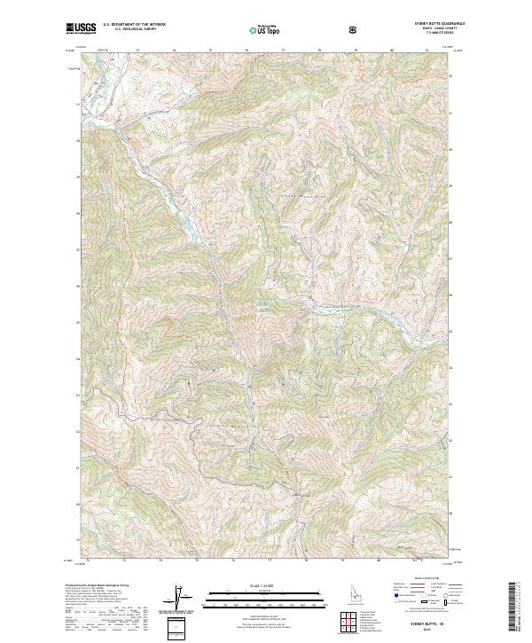
2023 Map of Sydney Butte
USGS Topo · Published 2023About this map
Worswick Hot Springs and the surrounding high-altitude drainage systems of the Sawtooth National Forest define this landscape on the northern edge of the Camas Prairie. The area is a rugged convergence of the Smoky Mountains and the Soldier Mountains, where water flows through complex systems like Little Smoky Creek and Worswick Creek. Modern access into these peaks is charted through a network of forest roads, including Big Smoky Rd and Natl Forest Develop Road 227 Rd, which follow historical corridors through deep canyons. High-altitude passes like Couch Summit separate distinct watersheds, while established pathways like the Grindstone-Big Peak Trl provide access to the area's prominent peaks. The map details a transition from the narrow gulches of the north to the broader ridges of Elk Ridge in the south, reflecting a landscape shaped by both geothermal activity and glacial erosion.
Find a feature on this map
45 named features on this map. Tap any name to fly to it.
Don’t see what you’re looking for? This feature index may not catch every label — zoom into the map to look around manually.
Map Details
Editions of this 2023 Sydney Butte Map
This is the sole edition of this map. No revisions or reprints were ever made.
Other maps of this area

1900 · Sawtooth
USGS Topo · 1:125,000

1955 · Hailey
USGS Topo · 1:250,000

1957 · Fairfield
USGS Topo · 1:62,500

1957 · Blaine
USGS Topo · 1:62,500

1959 · Hailey
USGS Topo · 1:250,000

1962 · Hailey
USGS Topo · 1:250,000

1970 · Sydney Butte
USGS Topo · 1:24,000

1970 · Paradise Peak
USGS Topo · 1:24,000
1970 · Newman Peak
USGS Topo · 1:24,000

1970 · Dollarhide Mtn
USGS Topo · 1:24,000