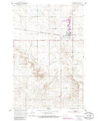
1986 Map of Sykeston
USGS Topo · Published 1986About this map
Sykeston serves as the focal point of this Wells County landscape, situated where the Burlington Northern railroad meets the winding course of Pipestem Creek. The map documents a blend of municipal life and state-managed conservation, centered on the Sykeston Dam and the surrounding Sykeston Dam State Wildlife Management Area. Water dominates the local geography, from the reservoir of Lake Hiawatha to the creek's seasonal floodplains.
Find a feature on this map
16 named features on this map. Tap any name to fly to it.
Don’t see what you’re looking for? This feature index may not catch every label — zoom into the map to look around manually.
Map Details
Editions of this 1986 Sykeston Map
This is the sole edition of this map. No revisions or reprints were ever made.
Other maps of this area

1948 · Cathay
USGS Topo · 1:62,500

1948 · Fessenden
USGS Topo · 1:62,500

1949 · Cathay
USGS Topo · 1:24,000

1949 · Cathay SE
USGS Topo · 1:24,000

1949 · Emrick
USGS Topo · 1:24,000

1951 · Heaton
USGS Topo · 1:24,000

1951 · Dover
USGS Topo · 1:24,000

1951 · Sykeston
USGS Topo · 1:24,000

1952 · New Rockford
USGS Topo · 1:250,000

1956 · New Rockford
USGS Topo · 1:250,000