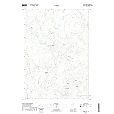
2019 Map of Sylvan Falls
USGS Topo · Published 2019About this map
Adirondack Park lands dominate this northern New York landscape, where the West Branch Saint Regis River carves a path through the dense forest. The river is marked by series of natural drops, including Sylvan Falls, Bruner Falls, and Kingsley Falls, highlighting the area's hydroelectric and timber history. Near the southern edge, the Coulon Cem provides a point of genealogical interest along the route to Joe Indian Rd. Small settlements and clearings like Fenner Meadows and Randle Meadows appear alongside numerous named peaks, such as Bear Mtn and Flower Hill. The complex drainage system includes substantial wetland features like Wheeler Marsh and The Bog, which feed into a network of remote water bodies including Sterling Pond and Hopkinton Pond. This 2019 survey documents the enduring wilderness character and the specific mountain passes like Sugar Grove Pass that defined movement through the region.
Find a feature on this map
49 named features on this map. Tap any name to fly to it.
Don’t see what you’re looking for? This feature index may not catch every label — zoom into the map to look around manually.
Map Details
Editions of this 2019 Sylvan Falls Map
This is the sole edition of this map. No revisions or reprints were ever made.
Other maps of this area

1908 · Potsdam
USGS Topo · 1:62,500

1919 · Nicholville
USGS Topo · 1:62,500

1920 · Childwold
USGS Topo · 1:62,500

1921 · Childwold
USGS Topo · 1:48,000

1921 · Nicholville
USGS Topo · 1:62,500

1921 · Stark
USGS Topo · 1:62,500

1922 · Childwold
USGS Topo · 1:62,500

1923 · Stark
USGS Topo · 1:62,500

1940 · Stark
USGS Topo · 1:62,500

1942 · Long Bow
USGS Topo · 1:24,000