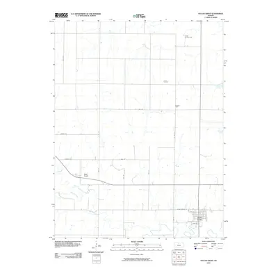
2009 Map of Sylvan Grove
USGS Topo · Published 2009About this map
Sylvan Grove occupies the southeastern corner of this central Kansas landscape, where the town's street grid meets the winding course of Wolf Creek. The surrounding Lincoln County terrain is defined by a rhythmic section-line road network, including routes like 204th Blvd and Amherst Rd, which segment the agricultural plains. Significant local markers include the Rosette Cemetery and Rosette Hall in the eastern portion of the quadrangle, serving as focal points for the rural community. To the north, the Vonada Landing Field provides a specialized transport node amidst the fields. Waterways such as Blue Stem Creek feed into the larger creek system, illustrating the natural drainage patterns that have historically dictated the placement of homesteads and early transportation corridors like W Old Highway 18.
Find a feature on this map
20 named features on this map. Tap any name to fly to it.
Don’t see what you’re looking for? This feature index may not catch every label — zoom into the map to look around manually.
Map Details
Editions of this 2009 Sylvan Grove Map
This is the sole edition of this map. No revisions or reprints were ever made.
Other maps of this area

1894 · Ellsworth
USGS Topo · 1:125,000

1894 · Beloit
USGS Topo · 1:125,000

1896 · Osborne
USGS Topo · 1:125,000

1896 · Russell
USGS Topo · 1:125,000

1955 · Great Bend
USGS Topo · 1:250,000

1955 · Beloit
USGS Topo · 1:250,000

1957 · Great Bend
USGS Topo · 1:250,000

1958 · Great Bend
USGS Topo · 1:250,000

1959 · Beloit
USGS Topo · 1:250,000

1962 · Vesper
USGS Topo · 1:24,000