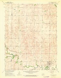
1963 Map of Sylvan Grove
USGS Topo · Published 1964About this map
Sylvan Grove serves as the focal point of this rural Kansas landscape, situated near the confluence of Wolf Creek and the Saline River. In the early 1960s, the town’s layout reflects a classic mid-century agricultural hub, supported by the Union Pacific railroad corridor which tracks alongside the river. The surrounding townships of Hanover, Fairview, and Pleasant are marked by a dense network of sections and section lines, indicative of the organized settlement patterns of the Great Plains.
Find a feature on this map
18 named features on this map. Tap any name to fly to it.
Don’t see what you’re looking for? This feature index may not catch every label — zoom into the map to look around manually.
Map Details
Editions of this 1963 Sylvan Grove Map
This is the sole edition of this map. No revisions or reprints were ever made.
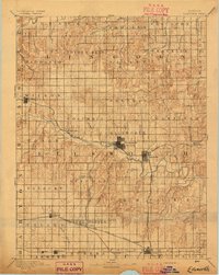
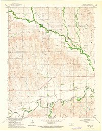
Other maps of this area
1894 · Ellsworth
USGS Topo · 1:125,000

1894 · Beloit
USGS Topo · 1:125,000

1896 · Osborne
USGS Topo · 1:125,000

1896 · Russell
USGS Topo · 1:125,000

1955 · Great Bend
USGS Topo · 1:250,000

1955 · Beloit
USGS Topo · 1:250,000

1957 · Great Bend
USGS Topo · 1:250,000

1958 · Great Bend
USGS Topo · 1:250,000

1959 · Beloit
USGS Topo · 1:250,000
1962 · Vesper
USGS Topo · 1:24,000