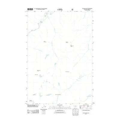
2011 Map of Sylvan Peak
USGS Topo · Published 2011About this map
Sylvan Peak stands as a central landmark in this high-altitude landscape within Carbon County, where the terrain is defined by sprawling plateaus and a dense network of alpine water systems. The Red Lodge Creek Plateau and East Rosebud Plateau dominate the upper elevations, giving way to the headwaters of numerous creeks including Hellroaring Creek and West Red Lodge Creek. Outdoor recreation and historical land use are anchored by sites like the Jimmy Joe Campground located along E Rosebud Rd near the northern edge of the survey area.
Find a feature on this map
27 named features on this map. Tap any name to fly to it.
Don’t see what you’re looking for? This feature index may not catch every label — zoom into the map to look around manually.
Map Details
Editions of this 2011 Sylvan Peak Map
This is the sole edition of this map. No revisions or reprints were ever made.
Other maps of this area

1898 · Granite Mountain District
USGS Topo · 1:125,000

1932 · Red Lodge No 2
USGS Topo · 1:48,000

1932 · Nye No 1
USGS Topo · 1:48,000

1954 · Billings
USGS Topo · 1:250,000
1956 · Emerald Lake
USGS Topo · 1:24,000

1956 · Roscoe
USGS Topo · 1:24,000

1956 · Alpine
USGS Topo · 1:62,500

1956 · Mackay Ranch
USGS Topo · 1:24,000

1956 · Mount Maurice
USGS Topo · 1:62,500

1957 · Billings
USGS Topo · 1:250,000