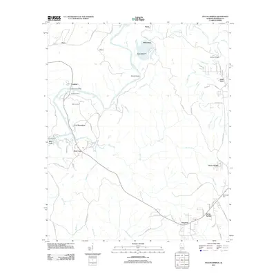
2011 Map of Sylvan Springs
USGS Topo · Published 2011About this map
Port Birmingham and the surrounding river-fed landscape of Jefferson County define this 2011 survey, showing a region where industrial infrastructure meets rural communities. The Locust Fork snakes through the center of the quadrangle, punctuated by landmarks like Atwood Ferry Bridge and Nichols Shoals. This area reflects the energy and transport economy of Alabama, anchored by the Miller Steam Plant Ash Pond Dam near Williamsburg. Smaller settlements like Powhatan, Short Creek, and Labuco are linked by a network of local roads such as Old Port Rd and Taylors Ferry Rd, while family histories are preserved at Atwood Cemetery and Salter Cemetery. In the southeastern corner, the residential growth of Sylvan Springs and Booker Heights contrasts with the industrial corridors, providing a detailed look at the modern footprint of these established communities.
Find a feature on this map
73 named features on this map. Tap any name to fly to it.
Don’t see what you’re looking for? This feature index may not catch every label — zoom into the map to look around manually.
Map Details
Editions of this 2011 Sylvan Springs Map
This is the sole edition of this map. No revisions or reprints were ever made.
Other maps of this area

1889 · Birmingham
USGS Topo · 1:125,000

1890 · Bessemer
USGS Topo · 1:125,000

1892 · Birmingham
USGS Topo · 1:125,000

1892 · Bessemer
USGS Topo · 1:125,000

1893 · Jasper
USGS Topo · 1:125,000

1895 · Birmingham
USGS Topo · 1:125,000

1899 · Brookwood
USGS Topo · 1:125,000

1904 · Birmingham Coal District
USGS Topo · 1:62,500

1905 · Bessemer Iron District
USGS Topo · 1:62,500

1906 · Birmingham Special
USGS Topo · 1:62,500